
Questions?
Email us at: JandK@LivingGoldPress.com
 HOME
HOME

| |
Email us at: JandK@LivingGoldPress.com
|
|
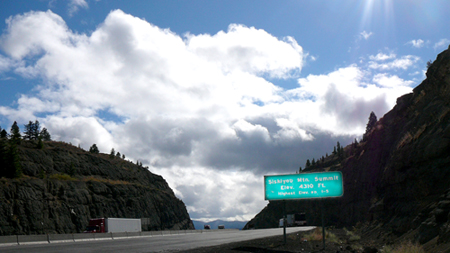
Highpoint of Highway 99, |
|
| Siskiyou Pass currently tops out at 4310'. | |
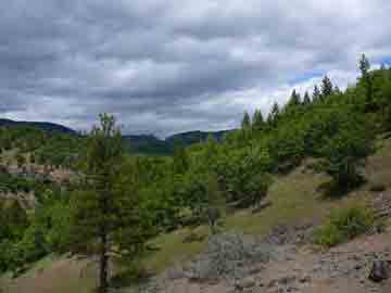
A distant view of the Siskiyou Pass road cut from the south. |
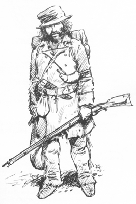 |
| A mid-1800s fur trapper such as crossed the Siskiyous with the Hudson's Bay Company brigade. Drawing by Rex Allen Norman from the book A Chronology of the American Fur Company by Alex Miller. |
|
|
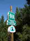
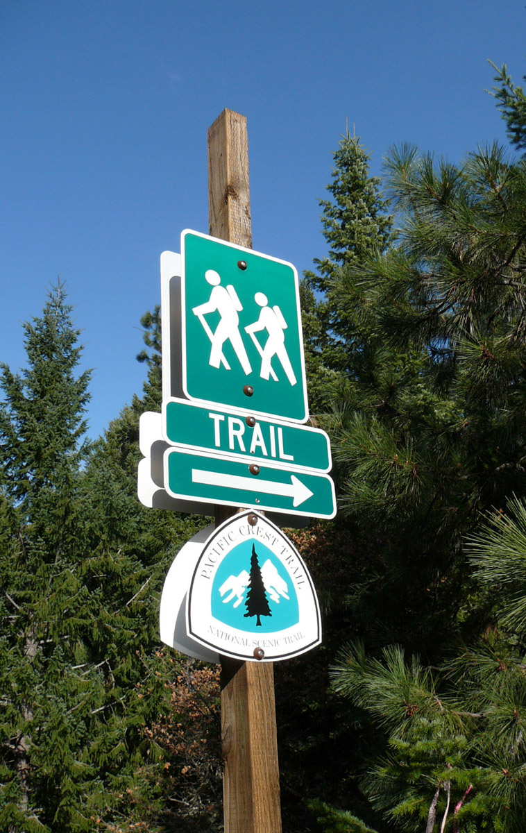
Some People still walk across the Siskiyous via the Pacific Crest Trail. GO TO a larger photo |
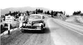 |
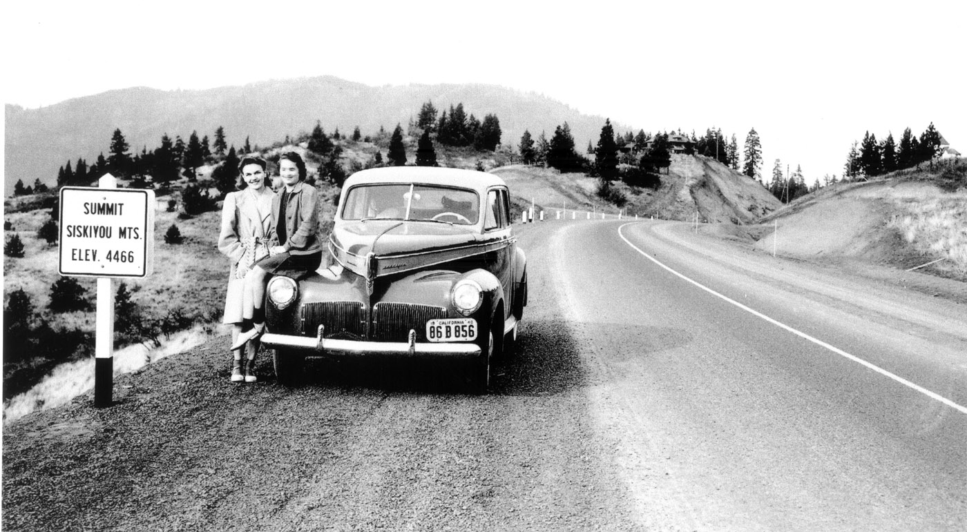
| More than 100 years after the first crossing of the Siskiyous by someone other than a Native, this "modern" US Highway 99 handily crossed the summit to the delight of two gals from Yreka, CA. GO TO a larger photo |
Part One |
|
Unless you are a born and raised Southern Oregonian—and there of fewer of these all the time--it’s likely that you caught your first peek of the rapidly growing greater Rogue Valley from atop Siskiyou Pass just before the steep descent northward down to the valley floor. Next time you make the crossing consider thinking beyond the delightful mountain air and distant views. Take a moment to contemplate the steady profusion mocossined or booted feet and assorted wheeled vehicles that traveled the narrow rough forerunner of our currently wide, flat and well-paved freeway.
At 4310’ in elevation Siskiyou Pass was US99's and is I-5’s highest point along the route that stretches through California, Oregon and Washington. The drive across the mountains is usually a pleasure but occasionally during winter snow or ice causes traffic to grind to a halt. Frustrating, inconvenient but ultimately humbling, a battle lost against nature that we foolishly fantasized had been won when the freeway came through. Even as travel progressively eased remnant geographically-enhanced cultural differences lingered. I well remember seeing “Don’t Californicate Oregon” graffiti scrawled on bridge abutments heading north into the state in the early 1970s.
On the other hand, over time a need to trade, desire to socialize or just simple curiosity motivated people to hit the road, or the trail, as it may be, to travel over the mountain or around the bend, often trekking year after year in much the same pathway. Thus Indian trail evolved into interstate freeway, barriers fell away and strangers became neighbors! In such a way the route over Siskiyou Pass that began as an Indian path evolved into Hudson Bay trapper trail, emigrant trail, toll wagon road, Pacific Highway, US 99, and lastly Interstate-5.
Beavers BewareNative Americans, two different bands of the Shasta tribe, resided in the river valleys on either side of the range, venturing into the high country to hunt or over the mountains to trade. The natives well knew the best path across when, in February 1827, Peter Ogden and his group of 40 trappers showed up on the south slope of the Siskiyous, anxious to cross over and trap beaver in the Rogue Valley. (The expedition had looped east of the Cascades on its southward journey from the Ft. Vancouver, Washington headquarters.) Ogden is credited with being “first over the Siskiyous,” but of course he was only the first white man, and he wouldn’t have managed so handily without Indian guides. The expedition’s crossing point of the mile-wide divide is thought to be Toll Road Gap (on what is now the road to Mt. Ashland ski area) a little west of the current freeway pass. The trappers then descended northward downslope along what would later become the Pacific Highway. The crossing must not have been too arduous for the group crossed again north-to-south on the homeward journey.
What were these Hudson’s Bay trappers of the Third Snake Country Brigade of 1826-1827 doing here anyway? In the early 1800s the ownership of this part of the North American continent was technically shared by Britain and the USA. Land to the north of the Siskiyous near the Columbia River (present Oregon/Washington border) and to the south along the Sacramento River and Yerba Buena (San Francisco) was lightly settled and adequately mapped, but the in-between region of far northern California and Southern Oregon was essentially unknown country, its boundaries a bit fuzzy. To Americans it was “Oregon Country” north of the 42nd parallel along which the Siskiyous generally run, and “Mexico” south of this line. To London-based Hudson’s Bay Company, “Oregon Country” was a portion of their vast Columbia Department that extended well north into present day Canada. Ogden was instructed to make this southern frontier of the Columbia Department into a “fur desert”, that is, to strip the land of beaver and thus make it unfruitful for American trappers to venture in from the south. The beaver take was good and Hudson’s Bay Company trappers returned on future expeditions. Other “traffic” over the Pass increased, a trickle of independent hunters and trappers and a few brave early settlers. In the mid-1830s Ewing Young drove herds of horses, mules and cattle over what soon became an established route called the Siskiyou Trail and in the process trampled and widened the trail, to the benefit of future travelers. He drove his stock (some of it likely stolen) up from Mexican-controlled California to sell to the scant 200 American settlers in Oregon, skirmishing with Indians along the way. Siskiyou Summit earned the moniker Bloody Pass from one such encounter. That there might be value in the land other than as a baby beaver nursery was not in their way of thinking. Scientists and SpiesThe next organized group of white men (and one woman) to cross Siskiyou Pass were members of the astounding United States Exploring Expedition of 1838-1842, the so-called Wilkes Expedition. This scientific expedition led by the US Navy was ten years in the planning, with artists, botanists, geologists, ethnographers, cartographers and other scientists all in tow, and was paid for by the United States Congress. The fact that this far-reaching ocean-based expedition included our own Pacific Northwest on its rich itinerary shows just how “foreign” was this area at that time! After leaving Massachusetts in six ships and rounding the Cape to explore South America, Samoa, Australia, Antarctica, Fiji and Hawaii, the group sailed back across the ocean to the Pacific Northwest. One ship was lost at the brutal entrance to the Columbia River. A replacement vessel was purchased from the Hudson’s Bay Company in Ft. Vancouver, on the north shore of the Columbia across from present-day Portland, Oregon. While the ship was being outfitted an offshoot land expedition comprised of the crew of the wrecked ship was sent south on foot. In spite of the British company’s generosity in selling the group a ship and providing travel tips, the overland expedition of 39 Americans was tasked with spying on Company activities along their way, plus any Mexican activity once they crossed into California.
The land expedition traveled on foot about 600 miles from the Columbia River south to the Sacramento River. Halfway through this journey in Sept. 1841 they ascended the slope to Siskiyou Pass. On the way up the expedition encountered flaming brush and trees ignited by Indians in an attempt to scare the men off. But in the previous two years the explorers had experienced floggings, near mutinies, a shipwreck with all hands lost in Antarctica and murderous attacks of spear-wielding South Seas islanders, so this confrontation barely fazed the group. They trekked on over the Siskiyous to meet their ship at San Francisco Bay a couple of weeks later. By the end of the same decade in which the Wilkes Expedition had sketched and mapped and journaled their wide-eyed way through our region, the trickle of travelers turned into a river after the discovery of gold in the west. The rush to the “Northern Mines” of far northern California and southern Oregon followed closely on the heels of the initial discovery in California’s Sierra Nevada. Jacksonville, Oregon on the north side of the Siskiyous and Yreka, California on the south side became the major gold mining and supply centers. The Siskiyou Trail was the only way across the mountains, a rough trip suitable for pack trains but extremely difficult by wagon. What the miners and the settlers that stayed after the gold rush needed was a real road over the Siskiyous. |